
Convert postcode to grid reference
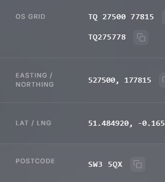
To convert a UK postcode to a grid reference, enter the postcode into the converter and it will return the OS grid reference, eastings, and northings.
A postcode is a postal identifier used to organise mail delivery. It can cover several addresses, so converting one to coordinates gives you a starting location for the postcode rather than the exact position of every building within it.
What is an OS grid reference?
An OS grid reference describes a location on the Ordnance Survey National Grid, also called the British National Grid. This is the mapping system used across Great Britain: England, Scotland, and Wales. Northern Ireland uses different grid systems.
The grid is divided into 100 km squares, each identified by two letters. The numbers that follow locate a smaller square within it. For example, in SU 123 456, SU identifies the large grid square, 123 gives the position east within it, and 456 gives the position north. Always read eastings first, then northings: across the map, then up.
A six-figure reference like this identifies a 100 m square. An eight-figure reference identifies a 10 m square, while a ten-figure reference identifies a 1 m square. More digits describe a smaller square; they do not make the original postcode location more accurate. See Ordnance Survey's guide to six-figure grid references for a visual explanation.
What are eastings and northings?
Eastings and northings express a position as two numbers measured in metres from the National Grid's origin. Eastings increase towards the east, and northings increase towards the north. Unlike latitude and longitude, which use degrees, these coordinates use a flat map grid.
They are useful for locating an area in GIS or CAD software and comparing it with other mapping in the same coordinate system.
The video shows how to enter a postcode and instantly get the grid reference and coordinates.
Convert postcode to grid reference