What is an OS Grid Reference?
An OS grid reference is a way of identifying a location in Great Britain using the British National Grid.
It works by dividing the map into squares and using letters and numbers to describe a position.
A typical OS grid reference looks like this:
ST 266 112
This tells you:
- which grid square you are in (letters)
- how far east you go (eastings)
- how far north you go (northings)
How to read an OS grid reference (step-by-step)
To read an OS grid reference:
- Find the correct two-letter grid square
- Read the easting (move right)
- Read the northing (move up)
- Combine them to pinpoint the location
👉 eastings first, then northings
Eastings and northings
Before looking at different grid references, it helps to understand how the numbers work.
In simple terms, eastings and northings are the map version of X and Y coordinates:
- Easting (X) → distance from the left, moving west to east
- Northing (Y) → distance from the bottom, moving south to north
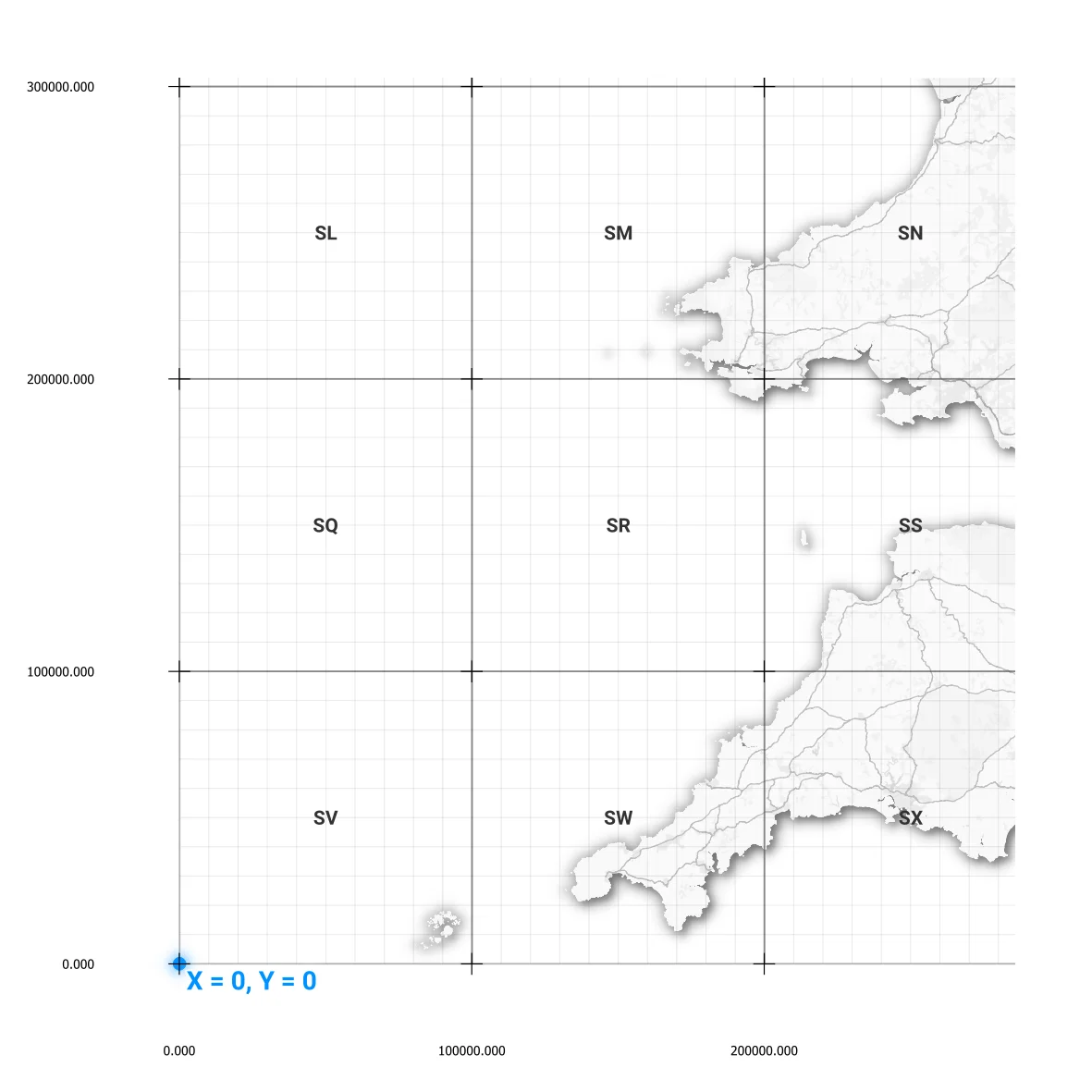
Where do eastings and northings start?
All OS grid references are measured from a fixed starting point known as the origin (0,0).
This point lies to the southwest of Great Britain, just off the Isles of Scilly.
- Eastings measure distance east from this point
- Northings measure distance north from this point
This ensures every location in Great Britain has a positive coordinate.
How OS grid references work (from large to precise)
OS grid references become more precise as you add more numbers. You start with a large area and gradually narrow it down.
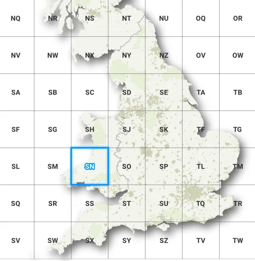
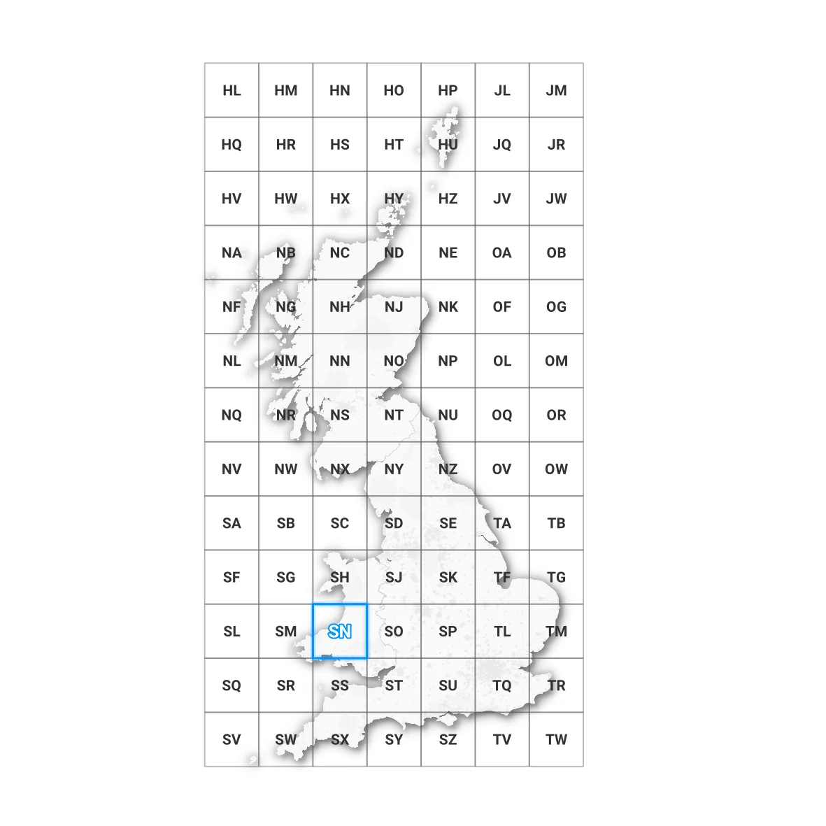
1. Letter pair (100 km square)
The two letters (for example ST) identify a 100 km × 100 km grid square.
This gives you the general area only.
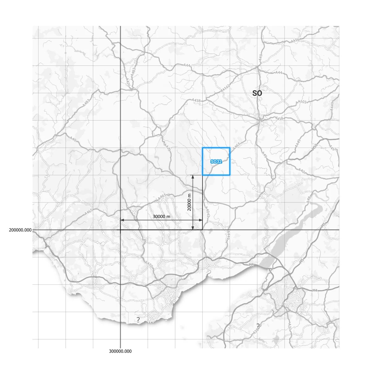
2. 2-digit grid reference (10 km precision)
A 2-digit reference per coordinate (e.g. SO 3 2) identifies a 10 km square.
- first digit → easting
- second digit → northing
This level is rarely used on its own but helps explain how the grid is subdivided.
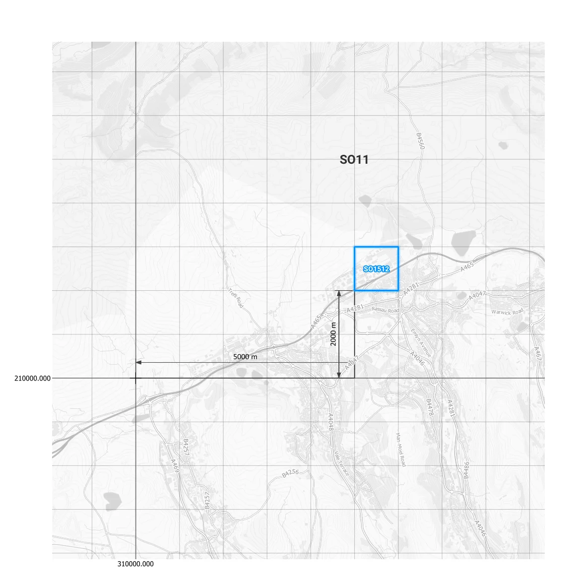
3. 4-figure grid reference (1 km precision)
A 4-figure grid reference (e.g. SO 15 12) identifies a 1 km square.
- first 2 digits → easting
- second 2 digits → northing
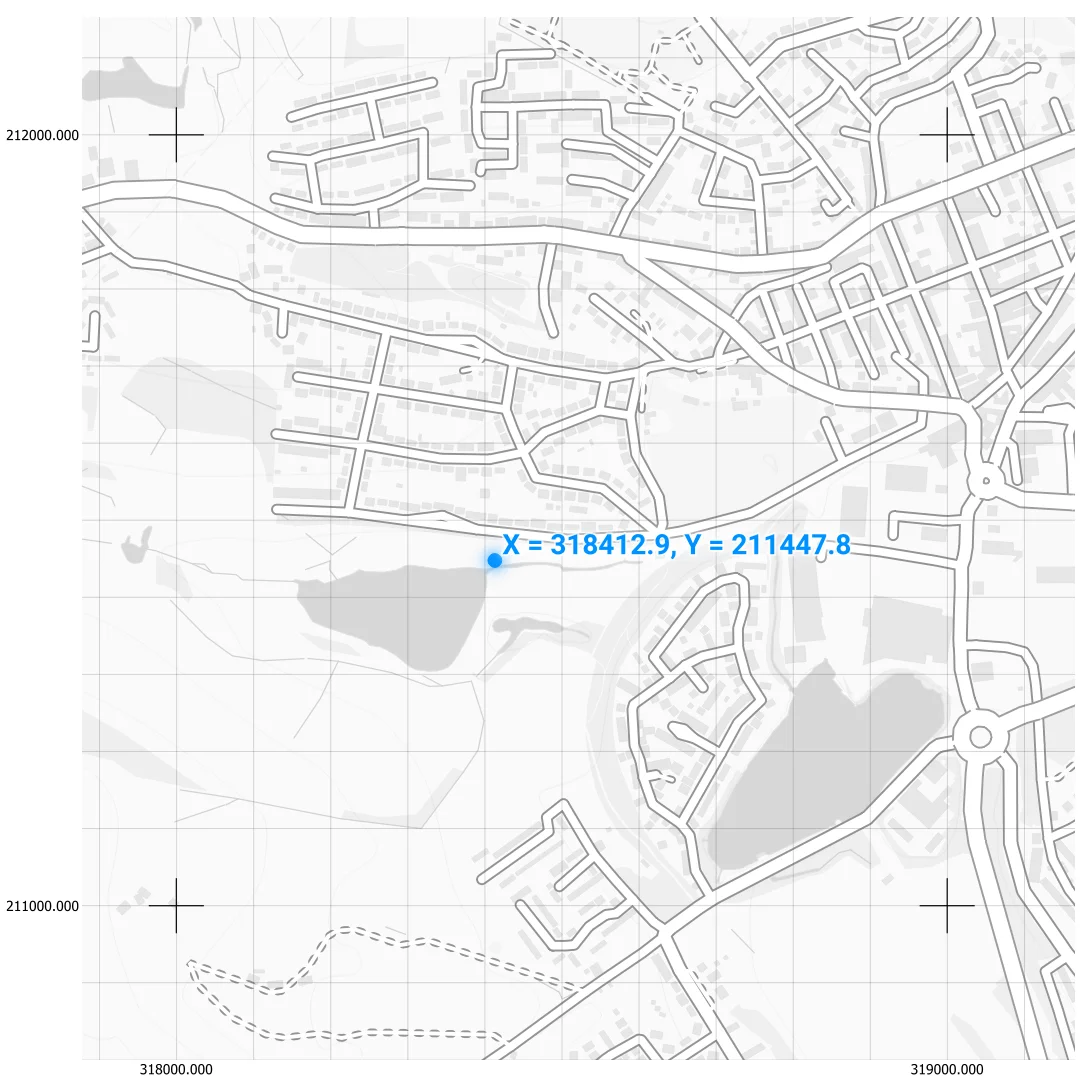
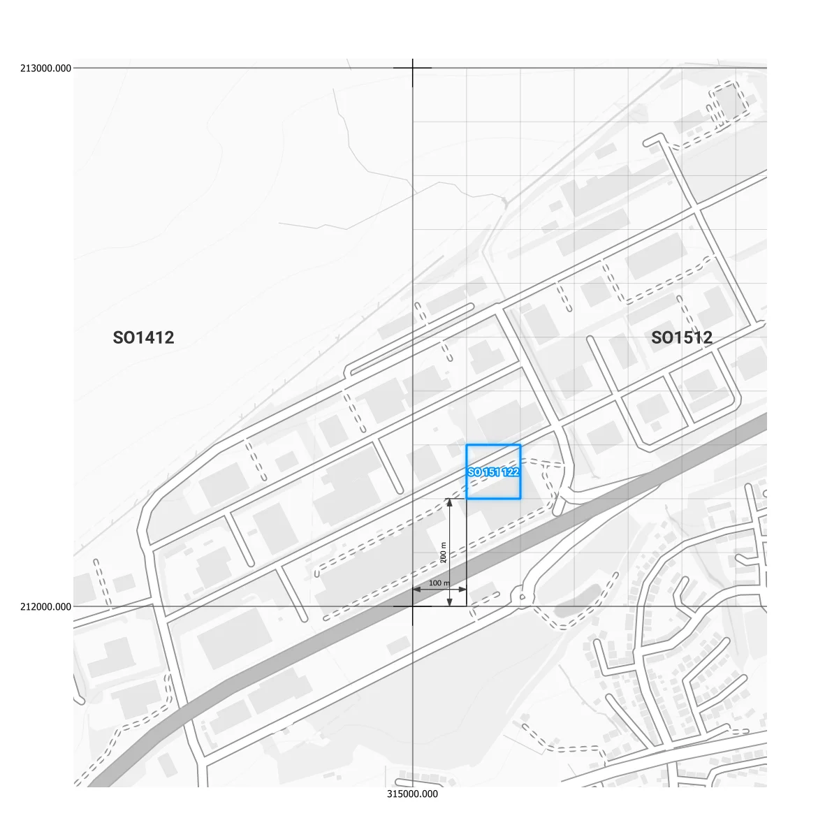
4. 6-figure grid reference (100 m precision)
A 6-figure grid reference (e.g. SO 151 122) identifies a 100 metre square.
- first 3 digits → easting
- second 3 digits → northing
This is the most commonly used format.
5. 8-figure grid reference (10 m precision)
An 8-figure grid reference (e.g. SO 1665 7123) identifies a 10 metre square.
This level of precision is used in surveying and detailed mapping.
The more digits you add, the more precise the location becomes.
Need to check a grid reference quickly?
Try our free OS Grid Reference tool →Example of an OS grid reference
SO 166 712
- SO → 100 km grid square
- 166 → easting (16.6 km across)
- 712 → northing (71.2 km up)
This identifies a 100 metre square on the map.
Find a grid reference instantly
Reading grid references manually takes practice.
Skip the manual steps.
Open the OS Grid Reference tool
- Convert coordinates to OS grid references
- Find locations instantly
- Get accurate results in seconds
Why OS grid references are used
OS grid references are widely used because they are:
- Easy to read on maps
- Consistent across Great Britain
- Suitable for both rough and precise locations
They are commonly used in:
- Navigation
- Surveying and engineering
- Mapping and planning
Frequently asked questions
What is a 6 figure grid reference?
A 6 figure grid reference identifies a 100 metre square by giving three digits for eastings and three for northings.
What is the difference between 4 and 6 figure grid references?
A 4 figure grid reference identifies a 1 km square, while a 6 figure grid reference identifies a more precise 100 metre square.
What are eastings and northings?
Eastings measure distance from west to east, and northings measure distance from south to north.